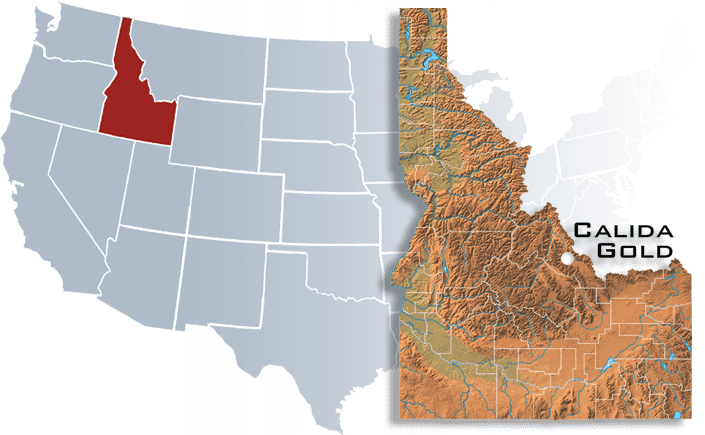
The Calida property is located approximately 24 miles south of Salmon, Idaho and 5 miles west of Highway 28 within the Mormon Canyon area.
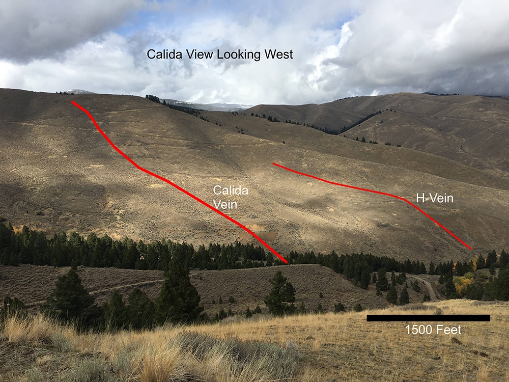
The property includes fifty-three (53) unpatented lode mining claims containing 160 acres. The claim block is situated on lands administered by the Bureau of Land Management. Calida consists of numerous old producing mines both surface and underground, having produced from seven separate shear zones containing important quantities of gold, silver, and copper.
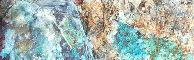
Genesis of the Calida ore deposits, simply put, is a series of intensely altered and mineralized shear zones hosting oxide and sulfide ore minerals. The shear zones range in size from 1.5 meters (5 feet) to over 30 meters (100 feet) in width and up to 4,267 meters (14,000 feet) in length. The shear zones represent a hydrothermal plumbing system for the migration of ore-bearing minerals throughout the zones of crushing and shearing. Mineralization consists of native gold, and gold-bearing copper and silver minerals. Most predominate in the system as tested includes the minerals of chalcopyrite, pyrite, chrysacolla, malachite, azurite, limonite, goethite, and assorted minerals containing both gold and silver.
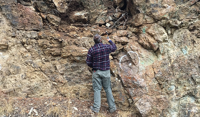
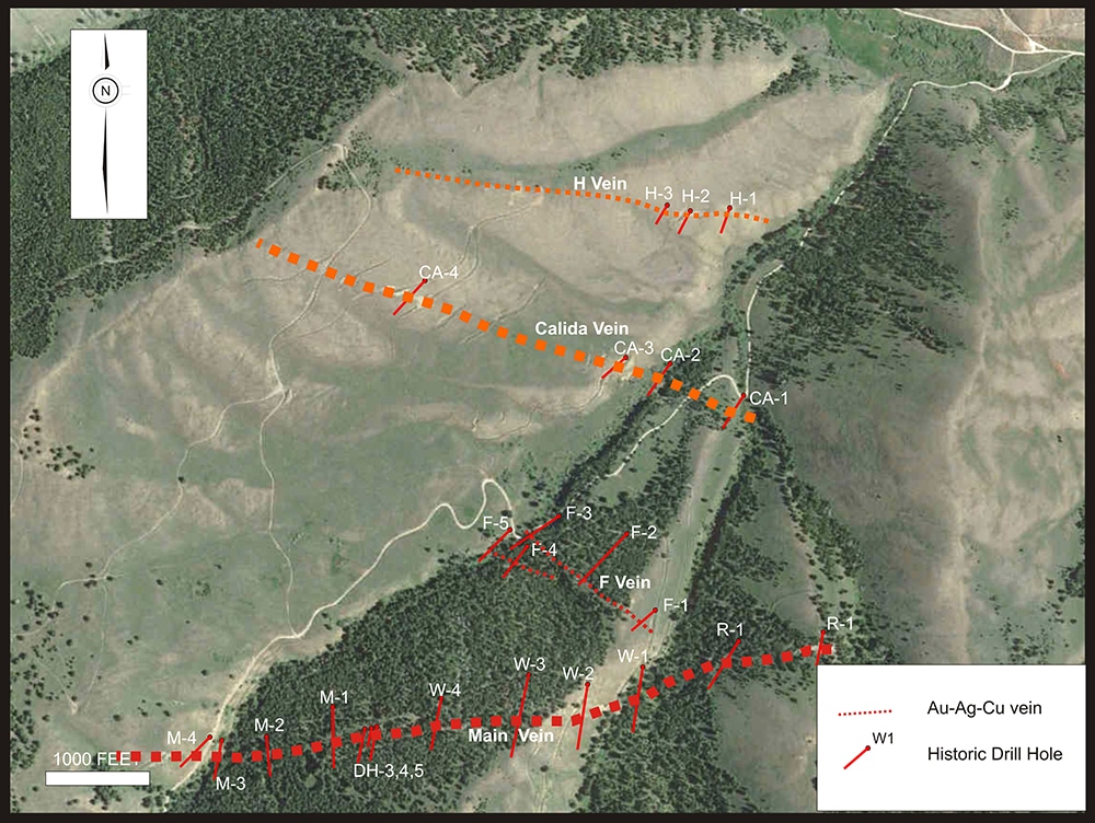
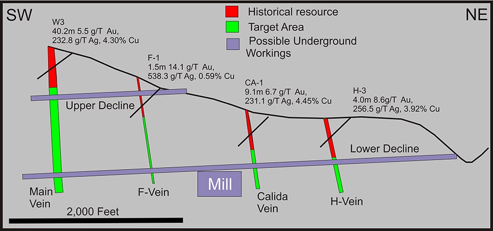
The property has been extensively explored for the past thirty years. Exploration has included drilling 29 holes in 1983 as well as thorough trenching and sampling. A total of ten mineralized veins have been identified on the property to date. Significant intersections from the drilling are listed below:
| Hole | Vein | From | To | Width | From | To | Width | Au | Au | Ag | Ag | Cu |
| meters | meters | meters | feet | feet | feet | g/T | oz/t | g/T | oz/t | % | ||
| W-3 | Main | 84.7 | 125.0 | 40.2 | 278 | 410 | 132 | 5.5 | 0.160 | 232.8 | 6.80 | 4.30 |
| M-1 | Main | 94.5 | 137.2 | 42.7 | 310 | 450 | 140 | 5.1 | 0.150 | 145.7 | 4.25 | 1.30 |
| R-2 | Main | 65.5 | 126.5 | 61.0 | 215 | 415 | 200 | 4.6 | 0.133 | 173.8 | 5.07 | 2.22 |
| CA-1 | Calida | 115.8 | 125.0 | 9.1 | 380 | 410 | 30 | 6.7 | 0.194 | 231.1 | 6.74 | 4.45 |
| F-1 | F-Vein | 55.8 | 57.3 | 1.5 | 183 | 188 | 5 | 14.1 | 0.410 | 538.3 | 15.7 | 0.59 |
| H-3 | H-vein | 54.9 | 58.8 | 4.0 | 180 | 193 | 13 | 8.6 | 0.250 | 256.5 | 7.48 | 3.92 |
In 2009, an independent resource calculation using the historic data was completed which defined a resource of 8,059,304 tons grading 0.168 ounces gold/ton, 6.12 ounces silver/ton and 2.86 percent copper.
The 2009 resource is considered an historical resource, as a technical report on the resource was never filed although the calculation was completed. It is the qualified person’s opinion that the resource is reliable having been done by a reputable independent third party who verified data and checked assays. A qualified person has not done sufficient work to classify the historical estimate as a current mineral resource. The Company is not treating the resource as a “current resource” and does not intend to rely on this resource but will use it as a guide.
Examination of available data indicates a target area of at least 100 meters (328 feet) wide, 1500 meters (4921 feet) long and 500 meters (1640 feet) deep that contains gold with copper bearing mineralization. CuMoCo has constructed a three-dimensional model of the veins and has identified a preliminary exploration target of between 8 and 30 million tonnes grading between 5 and 10 grams per tonne gold, 150 to 200 grams per tonne silver and 2 to 3 percent copper.
The Company intends to further the exploration and cautions that the target, the potential quantity and grade is conceptual in nature as exploration work done to define Mineral Resources as defined by NI 43-101 has been insufficient. It is uncertain if further exploration will result in establishing the existence of Mineral Resources.
There are no anticipated impediments to BLM jurisdiction permitting. The property was previously permitted and the BLM has all the prior data and reports in its files. If the mill site is placed on private property, the BLM has offered an opinion that permitting should be able to be expedited. Private property sites are available near the mine.